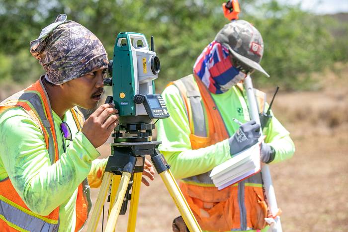
Land surveying is taking big measurements to map, describe, and document legal boundaries of the property and other features (location of existing infrastructure - buildings, utility lines, roads, trails, easements, means of access, zoning classifications, various improvements or other important observations). Some surveys also include mapping of the slope (topography) of the parcel. There are several types of land surveys. The most performed are: boundary surveys, ALTA/ACSM surveys, construction staking, subdivision surveys, or topographic surveys. Land surveys are used for planning and estimating engineering projects like construction of buildings, roads, bridges, pipelines, etc., for insurance purposes, or real estate transactions and their financing.
An ALTA Survey is boundary survey that provides detailed map of the property following standards set by American Land Title Association (ALTA) and the American Congress on Surveying and Mapping (ACSM). They are usually performed for the financing of the real estate transactions or for insurance of the properties. The goal of the ALTA Survey is to document all important features of the property that may affect its ownership. ALTA is a trade association that was established in 1907, and represents the title insurance industry.

A Topographic Survey is to document all elevations (height or depth), natural terrain features, and manmade features (improvements) of the property. Typically, topographic surveys are ordered by architects, engineers, or developers, but also by government, for example for environmental studies. The surveys can be done in various levels of detail which affect the cost of the survey. KN Surveying works closely with its clients to get their input on how much and which specific details from the terrain they would like to have rendered on the map.
Although Elevation Certificates are issued by land surveyors they are not the same things as land surveys. Elevation Certificates is typically requested for the purpose of determining flood insurance rates and to enforce local building ordinances. They document the location of the finished floor and adjacent land relative to the FEMA flood and tsunami zones.
Depends on the scope and type of the work, but we usually schedule field work within two weeks after the order. Most jobs involve a half to one day of field work. The final product – drawings, maps, documents, etc. are delivered in three to seven days after the field work.
KN Surveying is one of the biggest land surveyors in Hawaii. One a typical day, we have 4 crews in the field gathering data for various surveys. While the big surveying companies usually work only with the government and commercial clients, KN Surveying is proudly offers wide variety of land surveying services to all clients in Hawaii who need land surveys.